Landscape Projects
Project List
Aire Resilience Company
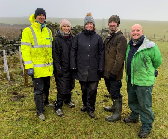
Image Credit: Image credit: Leeds City Council
Project Title: Aire Resilience Company
Programme: Leeds Flood Alleviation Scheme
Project Lead: Leeds City Council
Partners: Environment Agency, Leeds City Council, The Rivers Trust, Yorkshire Wildlife Trust, Aire Rivers Trust, Y&H Regional Flood & Coastal Committee. We also have involvement of the private sector with an increasing number and range of companies joining the ARC business consortium.
Funders: To establish and create the Aire Resilience Company we received funding from the Yorkshire & Humber Regional Flood & Coastal Committee, the Environment Agency and from a charitable contribution from Beyondly, an environmental consultancy based in the Aire catchment. ARC's central purpose to roll out and maintain natural flood management in the upper Aire catchment for which we are receiving subscriptions mostly from the private sector. They are 'buying' climate resilience, primarily reduced flood risk.
Nature of funding: Public sector (e.g. Defra), Private sector (commercial / corporate), Blended funding
Habitats: Rivers and streams, Broadleaved, Mixed and Yew Woodland (inc. orchards, wood pasture, lowland and upland woods) , Hedgerows
Dates: 2026 - 2069
Area: 1304 Ha - but this is working across the upper Aire catchment with an area greater than 356 square kilometres.
Goals and Objectives: The Aire Resilience Company (ARC) is a community interest company whose remit is the delivery and maintenance of natural flood management (NFM) in the upper Aire Catchment. NFM is an integral element of the Leeds Flood Alleviation Scheme. Slowing the flow and holding water in the upper catchment is the first line of flood defence for Leeds. ARC is a broker whereby the private sector 'buy's climate resilience thereby providing a climate resilient city and regional economy in which they operate. The premise being that you do not have to flood to be affected by flooding. Revenues raised then flow to farmer/landowners and land managers to host and maintain the NFM interventions for the long term in six identified priority sub catchments of the upper Aire. This provides a long-term sustainable revenue source which benefits rural, urban and private sector stakeholders.
Actions: Over five years ARC will deliver 1240 hectares of soil health interventions plus 64 hectares of further landscape interventions such as hedgerows, bunded hedgerows, tree planting etc.
Action List: Land / water management, Habitat / natural process restoration, Education / Training / Community Awareness, Regenerative practices (Agriculture / soils)*
Ecosystem Services: Flood and Drought, Soil Health
Baseline Monitoring: Yes
Accredited methods: Yes
Who is monitoring: Consultants, Researchers / Academics, Other
Data available: Not known
High level summary: The Aire Resilience Company (ARC) is an independent Community Interest Company (CIC) facilitating the delivery of long-term, evidence-based natural flood management interventions (NFM) in the mid and upper Aire Valley. These NFM measures will complement and enhance the protection afforded by the Leeds Flood Alleviation Scheme (LFAS). This approach will create long-term resilience against the impact of climate change and ensure the future protection of Leeds and its surrounding areas for decades to come. ARC is built on a consortium of local businesses and institutions all playing a leading role in increasing resilience and reducing the risk of the River Aire flooding in Leeds. As members of the ARC consortium, businesses benefit from enhanced flood risk reduction along with a range of additional benefits derived from using methods that work with nature to manage the impact of heavy rainfall.
Outputs: None at present
Project Contact: keith.davie@environment-agency.gov.uk
Link / URL: https://aireresilience.org/
Big Chalk
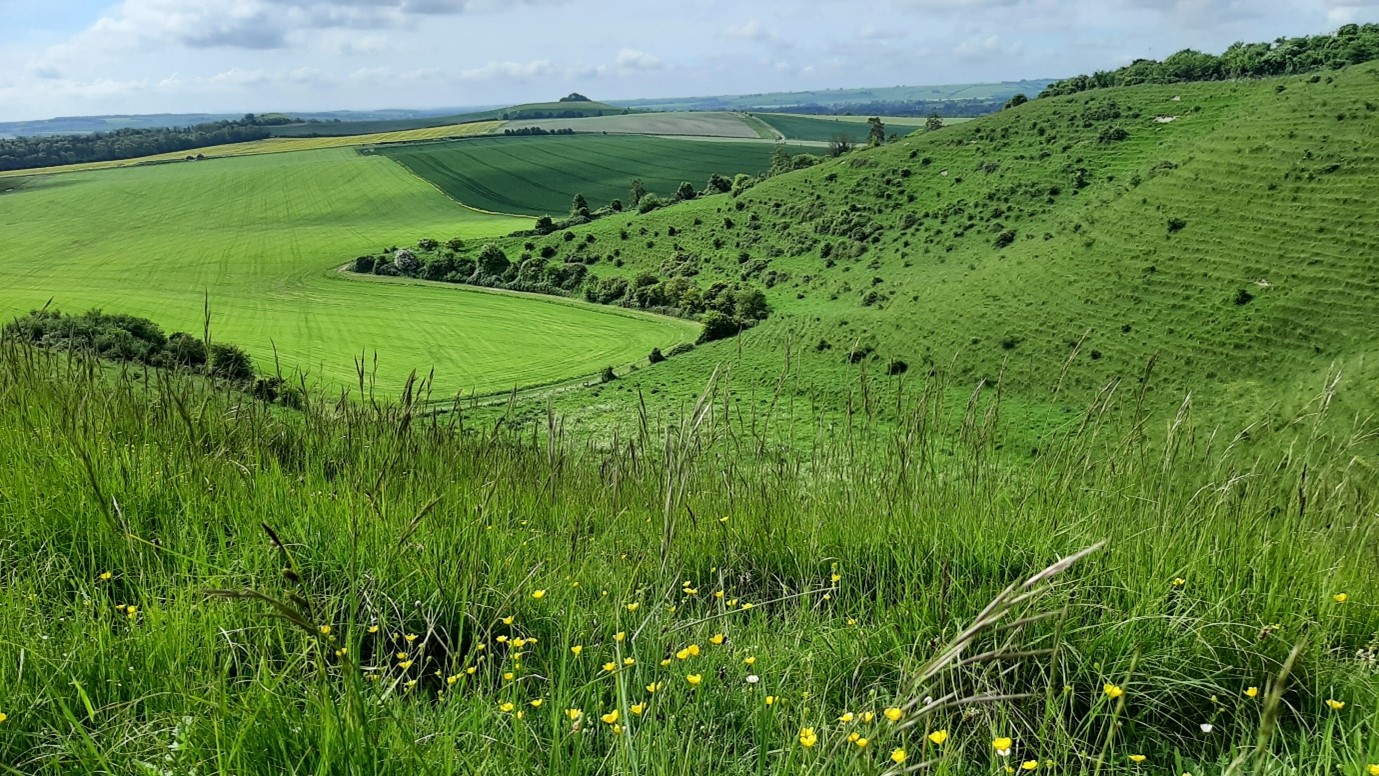
Image Credit: David Hoccom
Project Title: Big Chalk
Programme:
Project Lead: National Landscapes Association
Partners: The partnership currently consists of >150 partners (including 14 National Landscapes, the South Downs and 9 National Trails). 26 are currently on the Board: Bath & North East Somerset Council Butterfly Conservation Chilterns National Landscape Cotswolds National Landscape Cranbourne Chase National Landscape Dorset National Landscape Earth Trust Environment Agency Farming & Wildlife Advisory Group Isle of Wight National Landscape Kent County Council Kent Downs National Landscape Mendip Hills National Landscape National Farmers Union National Landscapes Association National Trails UK National Trust Natural England North Wessex Downs National Landscape Pasture for Life Plantlife RSPB Soil Association South Downs National Park Surrey Hills National Landscape Wiltshire Wildlife Trust
Funders: Defra (via the Protected Landscapes Partnership) funds Big Chalk directly. The partners have a wide variety of funders.
Nature of funding: Public sector (e.g. Defra), Private sector (commercial / corporate), Private sector (individual / estate), Agri-payments (CS / SFI), BNG, Blended funding
Habitats: Rivers and streams, Standing open water and canals, Broadleaved, Mixed and Yew Woodland (inc. orchards, wood pasture, lowland and upland woods), Coniferous woodland, Calcareous grassland, Neutral grassland, Dense scrub, Improved grassland (e.g. coastal and floodplain grazing marsh), Cropland (arable and horticulture / orchards), Urban (e.g. built and gardens, linear infrastructure), Hedgerows, Fen, marsh and swamp, Supralittoral rock (maritime cliff and slope)
Dates: 2021 - NA
Area: 2590000
Goals and Objectives: Our vision is to create nature-rich chalk and limestone landscapes that benefit all of us. Our mission is to collectively secure the future of nature in southern England's iconic chalk and limestone landscapes, by: - championing the global importance of their unique nature, - uniting nature recovery expertise to restore habitats and species, and - working with speed, scale and focus. By growing the size and reach of our partnership, we can increase the scale and pace of nature recovery activity across the Big Chalk geography (20% of England). This will help deliver national ambition and targets for nature while building ecological resilience to climate change, through significant improvements to: - the area, quality and connectivity of species-rich grasslands, woodland and farmland habitats, - the quality and function of England's chalk streams and rivers, and - the abundance and range of priority species. Wherever possible, we will seek and promote solutions which also deliver public goods, including protecting historic and cultural heritage, water management, soil health and carbon sequestration, natural beauty and health and wellbeing.
Actions: Big Chalk is a large area with lots of partners and so there are a wide range of actions being undertaken. A selection can be found at https://www.big-chalk.org/projects. Big Chalk also has a Nature Recovery Fund that can fund capital projects directly.
Action List: Land / water habitat protection (e.g. creating a reserve), Land / water management, Habitat / natural process restoration, Species-specific Management, Invasive/problematic species control (e.g. Rhododendron control), Habitat restoration and rehabilitation, Natural process mimicry (controls to simulate processes), Habitat creation (new features e.g. new woodlands, ponds etc), Habitat linking (joining isolated habitats), Habitat buffering (buffer zones from external threats), Incentive programmes / Conservation payments, Advisory Services, Education / Training / Community Awareness, Regenerative practices (Agriculture / soils)*
Ecosystem Services: Not known
Baseline Monitoring: Not known
Accredited methods: Not known
Who is monitoring: Not known
Data available: Not known
High level summary: Growing from an initial partnership of Protected Landscapes, the Big Chalk Partnership comprises more than 150 organisations with a common vision of creating thriving chalk and limestone landscapes across southern England. At its heart are 14 National Landscapes, the South Downs National Park and nine National Trails, including the iconic Ridgeway. Big Chalk performs a vital role in nature's recovery, connecting national targets and plans with participatory modes of delivery, including regional and local partnerships and farm clusters. Importantly, it helps ensure delivery is effective and makes the best use of the resources available. Big Chalk has been supported through several development phases, firstly by Natural England and then, since 2023, by the Protected Landscapes Partnership, supported by Defra. The National Landscapes Association hosts the programme lead.
Outputs: NA
Project Contact: david.hoccom@national-landscapes.org.uk
Link / URL: https://www.big-chalk.org/
Cumbria Connect
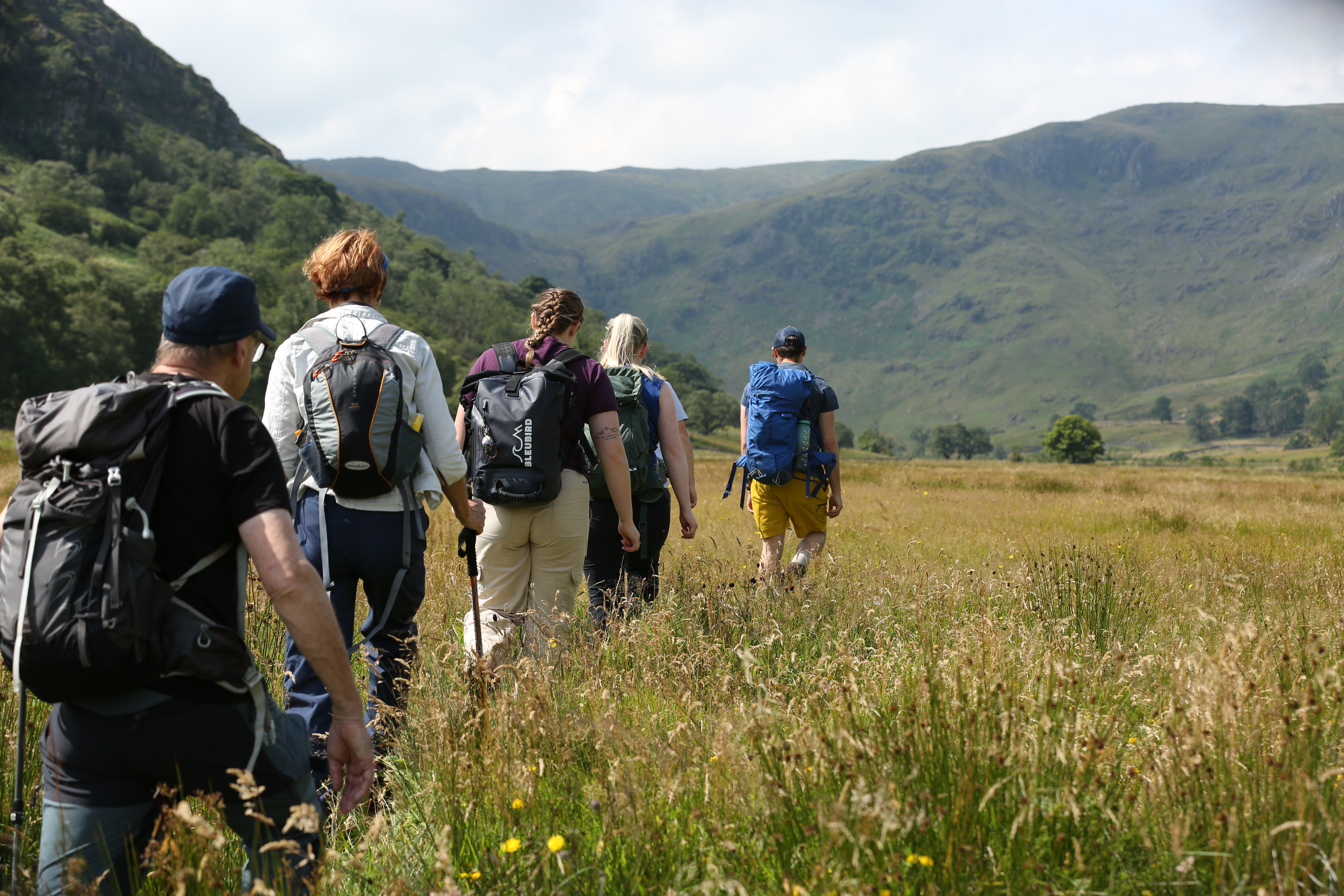
Image Credit: Cumbria Connect
Project Title: Cumbria Connect
Programme:
Project Lead: RSPB
Partners: Lowther Estate, United Utilities, Natural England
Funders: Endangered Landscapes and Seascape Fund
Nature of funding: Private sector (commercial / corporate), Private sector (individual / estate)
Habitats: Rivers and streams, Broadleaved, Mixed and Yew Woodland (inc. orchards, wood pasture, lowland and upland woods), Acid grassland, Hedgerows, Fen, marsh and swamp, Bogs, Montane habitat
Dates: 2023 - 2028
Area: 35000
Goals and Objectives: Our mission is rooted in the principles renowned ecologist, Sir John Lawton, outlined in his seminal report 'Making Space for Nature', which highlighted the need for a more connected and resilient natural environment. At Cumbria Connect, we believe that by linking fragmented habitats and creating stepping stones for wildlife, we can restore the health and vitality of our ecosystems in a way that truly has an impact. With generous funding of £4.1 million from the Endangered Landscapes & Seascapes Programme, we're embracing nature-friendly farming practices and working together to make bigger, better and more connected habitats and creating a wilder future for wildlife and people. From reintroducing endangered species like water voles to restoring precious peatlands, we're tackling habitat loss head-on, with plenty of opportunities to get involved. Healthy ecosystems provide cleaner air and water, improved flood control, better soil health and a boost to biodiversity. It's a win-win for both nature and people.
Actions: Restoring natural processes - restoring hydrology, native woodland expansion, peatland restoration, species reintroduction - community engagement, building trust and sharing power
Action List: Land / water habitat protection (e.g. creating a reserve), Land / water management, Habitat / natural process restoration, Species-specific Management, Habitat restoration and rehabilitation, Natural process mimicry (controls to simulate processes), Habitat creation (new features e.g. new woodlands, ponds etc), Habitat linking (joining isolated habitats), Habitat buffering (buffer zones from external threats), Education / Training / Community Awareness, Regenerative practices (Agriculture / soils)*
Ecosystem Services: Carbon / Net Zero / GHG, Biodiversity, Health and Wellbeing, Cultural
Baseline Monitoring: Yes
Accredited methods: Yes
Who is monitoring: Project team, Volunteers, Researchers / Academics
Data available: No
High level summary: Collaborative restoration of natural process and increased connectivity at scale
Outputs: None to date
Project Contact: martin.varley@rspb.org.uk
East Kent Downs Landscape Recovery Project
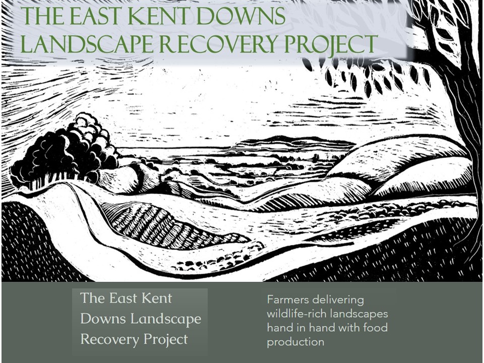
Image Credit: Dan Tuson
Project Title: East Kent Downs Landscape Recovery Project
Programme: n/a
Project Lead: Natural England
Partners: 120 farmers /landowners (all private farms of varying sizes from 3ha to 2000 plus ha ) and of mixed enterprises : livestock/arable
Funders: The majority of the work is carried out through funding through agri environment schemes. A small part of the work (2 farms) is funded through BNG and a small amount of funding is from Affinity Water
Nature of funding: Public sector (e.g. Defra), Private sector (commercial / corporate), Agri-payments (CS / SFI), BNG
Habitats: Rivers and streams, Broadleaved, Mixed and Yew Woodland (inc. orchards, wood pasture, lowland and upland woods) , Acid grassland, Calcareous grassland, Neutral grassland, Dense scrub, Improved grassland (e.g. coastal and floodplain grazing marsh), Cropland (arable and horticulture / orchards), Hedgerows
Dates: 1995 - 2040
Area: 2000ha (note this is solely the area of land directly under species rich grassland creation - this is the only measurement we use to define the area of 'high value' interventions for nature recovery (i.e we don't include existing /relic species rich grassland nor do we include other areas of farms and holdings that are being managed for nature conservation)
Goals and Objectives: The East Kent Downs Landscape Recovery Project is a Natural England led initiative and the culmination of over 25 years of working with farmers on habitat creation and nature recovery projects in the farmed landscapes of east kent. Using agri environment schemes as the main tool and building long term relationships with over 120 farms, the project has pioneered a novel approach to the way that the schemes are delivered. The project's key ambition has been to work, farm by farm, creating species-rich grasslands from arable land and grass-dominated pastures. Wildflower diversity is achieved through a combination of natural regeneration, native provenance wildflower seeding and green hay spreading with the overall ambition of achieving a new generation of floristically and structurally diverse grasslands. Restoring insect and seed-rich landscapes in this way delivers a sustainable long term and resilient resource of grasslands that drives species recovery across a broad range of taxa, in addition to all the attendant benefits to soil health, water quality and carbon capture. An annual rolling programme of new wildflower grassland creation is undertaken each year to ensure that there is a continual succession of new grasslands being created which helps to continually expand the network year by year. Supplementing this with a wider patchwork of the nature friendly farming measures such as grassy margins, bee and bird food plots, regenerative farming practices, and woodland management ensures that nature and food production can go hand in hand. The project is organised into three 'farmer groups' each comprising 30 or more farms who come together to share knowledge, learn and celebrate their successes. Critical to the central 'wildflower-grassland' focus of the project is a close 1-1 working relationship between each farm and a Natural England adviser so that, together, the combined commitment of each farm is able to deliver a well connected network of 'high nature value' habitats across the landscape of the East Kent Downs.
Actions: Using agri environment schemes as the main tool and building long term relationships with over 120 farms, the project has pioneered a novel approach to the way that the schemes are delivered. The project's key ambition has been to work, farm by farm, creating species-rich grasslands from arable land and grass-dominated pastures. Wildflower diversity is achieved through a combination of natural regeneration, native provenance wildflower seeding and green hay spreading with the overall ambition of achieving a new generation of floristically and structurally diverse grasslands. Restoring insect and seed-rich landscapes in this way delivers a sustainable long term and resilient resource of grasslands that drives species recovery across a broad range of taxa, in addition to all the attendant benefits to soil health, water quality and carbon capture. An annual rolling programme of new wildflower grassland creation is undertaken each year to ensure that there is a continual succession of new grasslands being created which helps to continually expand the network year by year. Supplementing this with a wider patchwork of the nature friendly farming measures such as grassy margins, bee and bird food plots, regenerative farming practices, and woodland management ensures that nature and food production can go hand in hand.
Action List: Land / water habitat protection (e.g. creating a reserve), Land / water management, Habitat / natural process restoration, Species-specific Management, Habitat restoration and rehabilitation, Natural process mimicry (controls to simulate processes), Habitat creation (new features e.g. new woodlands, ponds etc), Habitat linking (joining isolated habitats), Habitat buffering (buffer zones from external threats), Incentive programmes / Conservation payments, Advisory Services, Education / Training / Community Awareness, Regenerative practices (Agriculture / soils)*
Ecosystem Services: Carbon / Net Zero / GHG, Biodiversity
Baseline Monitoring: Yes
Accredited methods: Yes
Who is monitoring: Project team, Landowner / tenants, Volunteers, Researchers / Academics
Data available: No
High level summary: The East Kent Downs Landscape Recovery Project, running since 1995, demonstrates how a long term focus on creating a new generation of species rich grasslands (2000ha currently created), year by year, is able to drive nature recovery across a wide range of taxa across 120 farms. Critical ingredients include close 1 to1 working with each farm, an opportunity driven approach to allow the network of new grasslands to evolve organically (i.e not based on target areas or driven by 'lines on maps') and building long term relationships with the farming community. Successes include population and distribution increases (new colonisations) in many generalist and specialist butterfly, moth, bumblebee, bat, bird and mammal species (e.g duke of burgundy, small blue, dingy skipper, bright wave moth, brown banded carder bee, large scabious mining bee, yellowhammer, linnet, barn owl, corn bunting, serotine bat, brown hare)
Outputs: Summary report published in Conservation Land Management journal : https://www.eastkentdownsfarmers.co.uk/_files/ugd/051a3b_f99f1c431b244e67aab4097b6b36a644.pdf Map of created wildflower grasslands (2000ha) https://www.eastkentdownsfarmers.co.uk/_files/ugd/051a3b_9751c3a94a764b35813a16bcbafe80b3.pdf
Project Contact: daniel.j.tuson@naturalengland.org.uk
Link / URL: https://www.eastkentdownsfarmers.co.uk/
East Kent Downs Landscape Recovery Project
Farmers, Landowners, Northern Brown Argus and Species-rich Grasslands
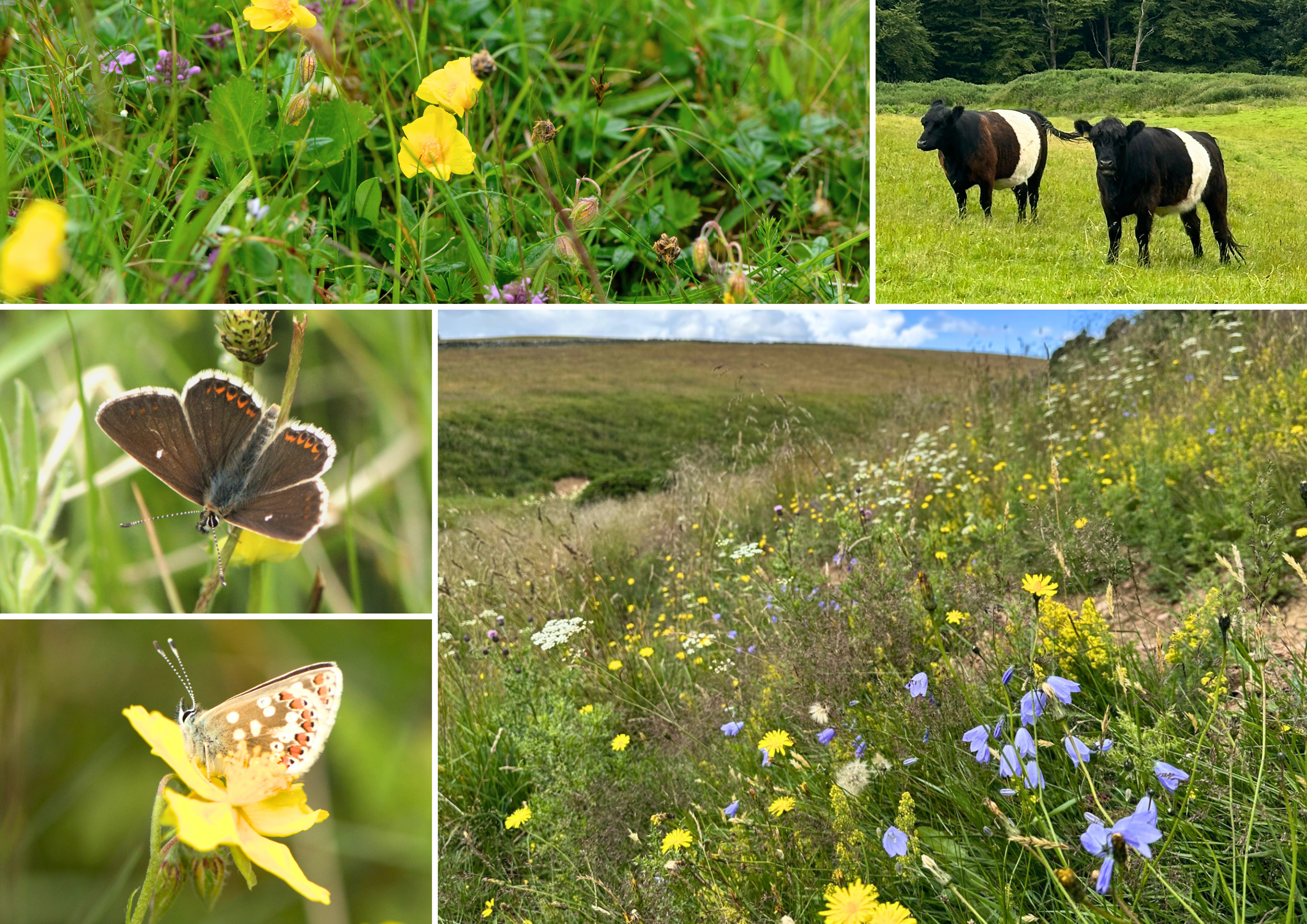
Image Credit: Apithanny Bourne 2025
Project Title: Farmers, Landowners, Northern Brown Argus and Species-rich Grasslands
Programme: Borderlands Inclusive Growth Deal - Natural Capital Programme
Project Lead: Butterfly Conservation
Partners: Scottish Borders Council
Funders: Borderlands Inclusive Growth Deal
Nature of funding: Public sector (e.g. Defra)
Habitats: Acid grassland, Calcareous grassland, Neutral grassland
Dates: 2025 - 2030
Area: 500
Goals and Objectives: Our aim is to develop a more sustainable approach to hill farming in south Scotland, that benefits both biodiversity and the rural economy. Butterfly Conservation will work closely with farmers and other landowners to restore at least 400 hectares of degraded grassland back into thriving, species-rich habitat. The Northern Brown Argus butterfly is our flagship species, due to its reliance on low intensity, seasonal grazing by cattle. Grassland will be restored through a variety of management trials and case studies, which will help to inform future grassland projects and agricultural policy.
Actions: Species-rich grassland restoration, management and new meadow creation.
Action List: Habitat / natural process restoration, Species-specific Management, Habitat creation (new features e.g. new woodlands, ponds etc)
Ecosystem Services: Biodiversity, Soil Health, Improved farm economics, Cultural
Baseline Monitoring: Yes
Accredited methods: Yes
Who is monitoring: Project team, Consultants
Data available: No
High level summary: Our aim is to develop a more sustainable approach to hill farming in south Scotland, that benefits both biodiversity and the rural economy.
Outputs: Results of our management trials will be published as case studies in 2030. Trials include gorse removal, bracken control, conservation grazing and meadow creation.
Project Contact: abourne@butterfly-conservation.org
Link / URL: https://butterfly-conservation.org/borderlands
Farmers, Landowners, Northern Brown Argus and Species-rich Grasslands
LIFE WADER
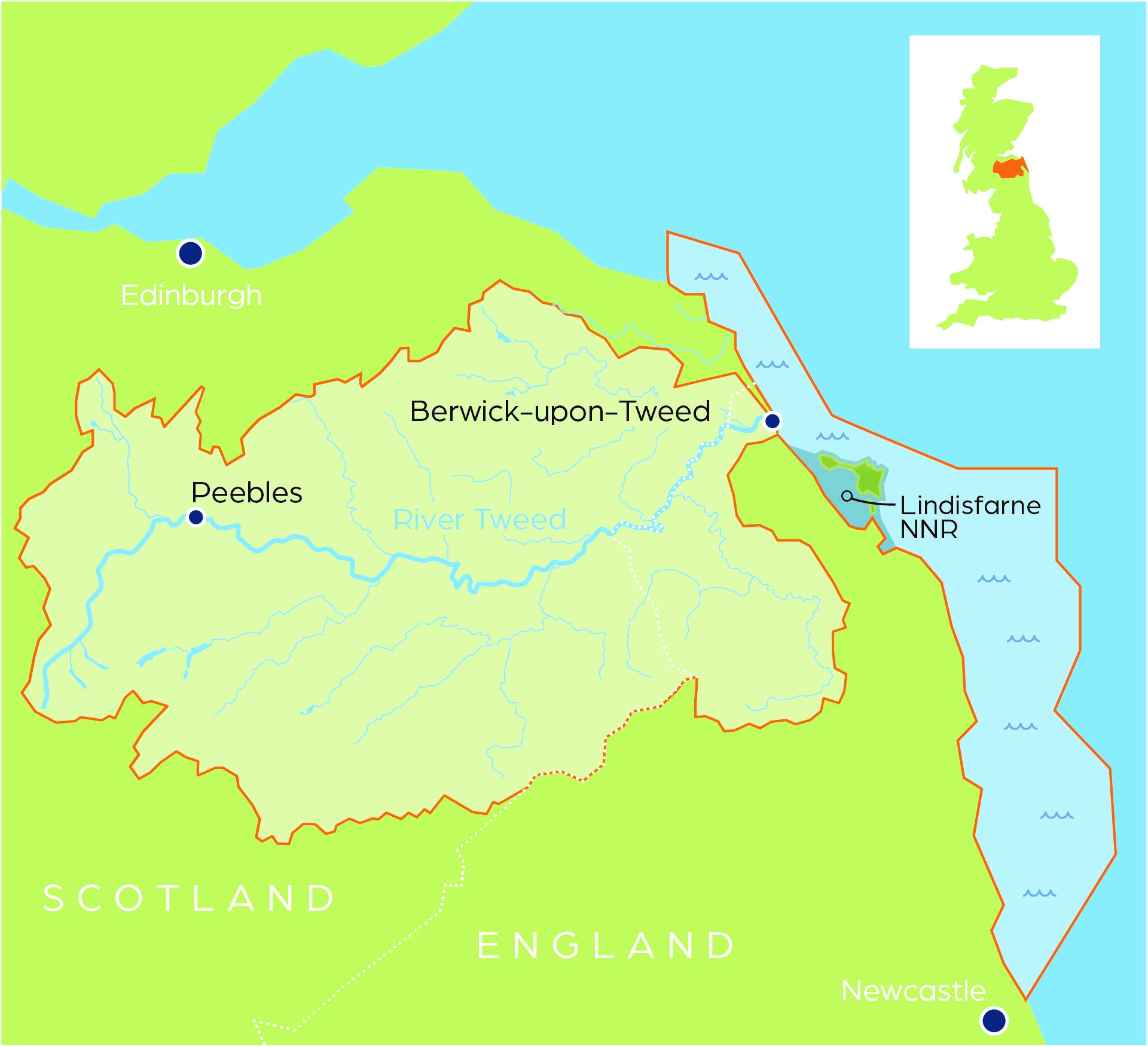
Image Credit: LIFE WADER
Project Title: LIFE WADER
Programme: Liz Humphreys
Project Lead: Natural England
Partners: Natural England Environment Agency Tweed Forum Newcastle University
Funders: EU LIFE Programme Natural England Environment Agency Tweed Forum Newcastle University
Nature of funding: Public sector (e.g. Defra)
Habitats: Rivers and streams, Broadleaved, Mixed and Yew Woodland (inc. orchards, wood pasture, lowland and upland woods) , Cropland (arable and horticulture / orchards), Supralittoral sediment (e.g. sand dunes, vegetated shingle), Littoral sediments (e.g. saltmarsh, mudflats), Sublittoral / marine sediments (e.g. Subtidal Muds, Sands and Gravels - e.g. subtidal seagrass beds)
Dates: 2021 - 2027
Area: 70,242
Goals and Objectives: LIFE WADER is a five-year project to improve the condition of the river, intertidal and marine habitats of the Northumberland Coast and Tweed catchment for the species that depend on them. Spanning 70,242ha from the SE Scottish border along the Northumbrian coast, including the Tweed catchment, the project area includes four Special Areas of Conservation (SACs) and two Special Protection Areas (SPAs). By tackling issues affecting site condition targeting 10 Annex I habitats, 3 Annex II species & associated SPA bird interests, LIFE WADER aims to ensure these become sites more resilient to climate change. This partnership project takes a 'source to sea' approach to improve > 49,000 hectares of habitat by: 1. Reversing the decline of freshwater/coastal/marine habitats & species 2. Demonstrating best practice to businesses, policy makers and land managers 3. Increasing awareness of the importance and vulnerability of the SAC/SPA sites
Actions: Objective 1: Reverse the decline of freshwater/coastal/marine habitats & species Actions: • Delivering river restoration on the River Till / Breamish. • Creating reed beds and demonstration projects to address pollution from agriculture and other sources, reducing the level of nutrients entering the marine environment. • Planting trees and installing fencing along river corridors to improve the riparian zone and reduce risk of diffuse pollution. • Sympathetically removing opportunistic (macro)algae (which is smothering intertidal habitats) and identifying different ways the removed material can be used. • Reducing disturbance of birds, mammals, and sensitive habitats by assessing how many visitors an individual site can tolerate; and identifying pressure points and enhancing visitor management through an increase in the use of seasonal wardens, interpretation, revised bylaws and the creation of wildlife refuges. • Improving the control of INNS through better surveillance, new surveying techniques, improved detection and subsequent removal across freshwater, marine and dune land habitats, using non-chemical controls. • Enhanced cross-border working with regulators on water quality & IAS. Objective 2: Demonstrate best practice to businesses, policy makers and land managers Actions: • Developing freshwater/marine eDNA and ecosystem monitoring systems to better target restoration interventions and involve greater use of citizen science. • Increase knowledge/skills at local/ national/transnational levels including replicating work at 20 sites. Objective 3: Increase awareness of the importance and vulnerability of the SAC/SPA sites Actions: • Highlighting designated features, such as the bird assemblages' inter-dependence on the wider coastal ecosystem, reaching up to 500,000 people per year. • Inspiring the need for more sustainable management and care from a wide range of users, volunteers, stakeholders, businesses, regulators, visitors and communities.
Action List: Land / water management, Habitat / natural process restoration, Habitat restoration and rehabilitation, Invasive/problematic species control (e.g. Rhododendron control), Habitat creation (new features e.g. new woodlands, ponds etc), Education / Training / Community Awareness, Regenerative practices (Agriculture / soils)*
Ecosystem Services: Biodiversity, Soil Health, Water Quality, Recreation and tourism
Baseline Monitoring: Yes
Accredited methods: Yes
Who is monitoring: Project team, Researchers / Academics
Data available: Not known
High level summary: LIFE WADER is a five-year project aimed at improving the condition of the river, intertidal and marine habitats of the Northumberland coast and Tweed catchment for the species that depend on them. LIFE WADER has taken a catchment to coast approach to nature recovery looking at the bigger picture through a landscape-scale lens. Spanning 70,242ha from the SE Scottish border along the Northumbrian coast, including the Tweed catchment, and the Lindisfarne National Nature Reserve. LIFE WADER set out to tackle four major issues prevalent in the area: declining water quality, excessive algal growth, increasing spread of invasive species and growing recreational pressure on wildlife habitats. Through the trial of innovative solutions and demonstration of established practice these trends have begun to be reversed allowing nature to recover and become more resilient in the face of a changing climate. Alongside practical nature recovery solutions the project also set out to raise levels of awareness about the importance and interconnectivity of this special area. LIFE WADER has shown that small scale improvements achieved at the local level, when scaled up to catchment scale can bring enormous benefits to habitats, wildlife and people, delivering financial gains, improving and protecting ecosystems and enhancing visitor experiences.
Outputs: Marine Invasives protocol: Molecular monitoring of biofouling communities using settlement panels and diagnostic assays https:// dx.doi.org/10.17504/protocols.io.36wgqpm8kvk5/v1 The Tweed Catchment Biosecurity Plan: https://storymaps.arcgis.com/stories/5f02734c56634a38a7f46422c2f9cb2c TweedWATCH Education Pack - Destination Tweed : Destination Tweed https://destinationtweed.org/tweedwatch-education-pack/ Short film Restoring Budle Bay in Northumberland: https://www.youtube.com/watch?v=SgTmobee-BU River Restoration Film: https://tweedforum.org/our-work/projects/harehope-restoration-project/ .....much more to come
Project Contact: liz.humphreys@naturalengland.org.uk
Link / URL: https://lifewader.co.uk/
Living Levels Landscape Partnership
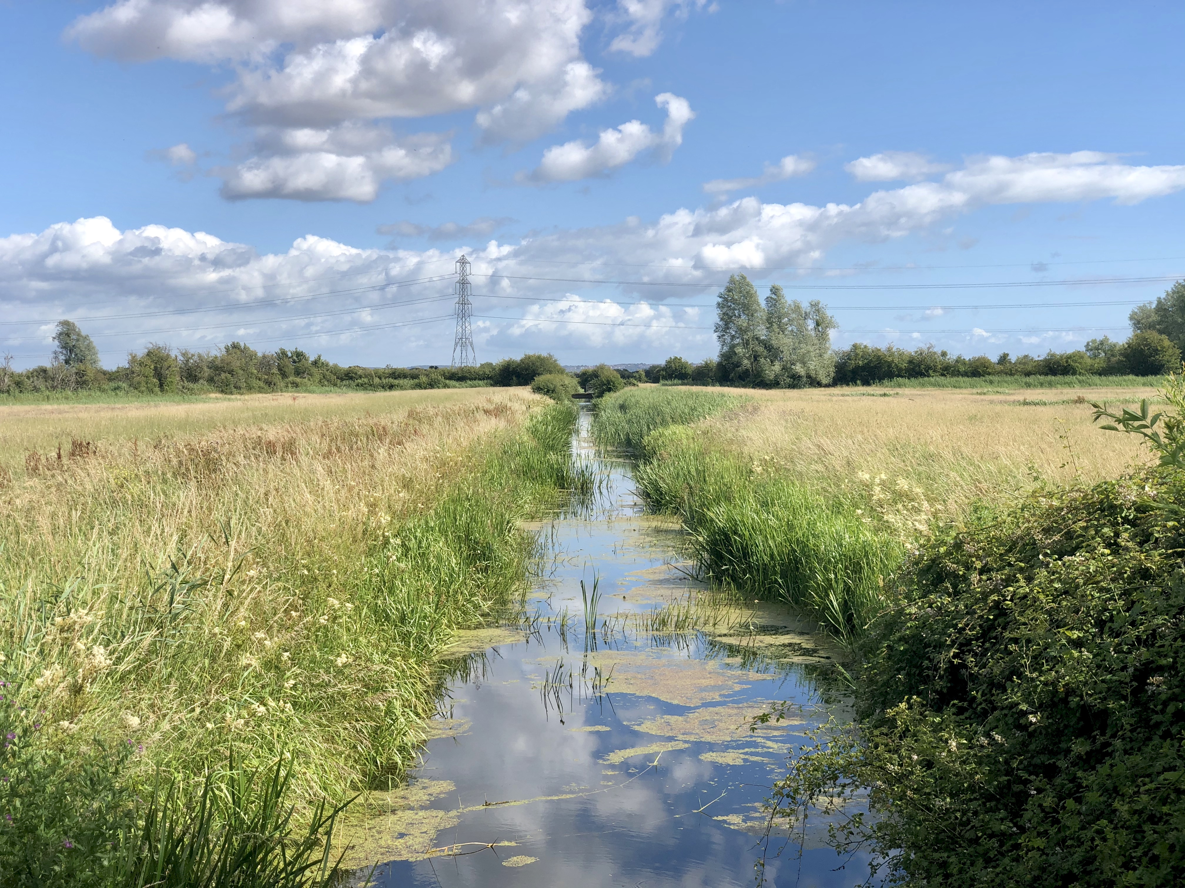
Image Credit: Chris Harris, Living Levels Landscape Partnership
Project Title: Living Levels Landscape Partnership
Programme: Our Living Levels
Project Lead: RSPB Cyrmu
Partners: Natural Resources Wales, Gwent Wildlife Trust, Cadw, Monmouthshire County Council, Newport City Council, Cardiff City Council, Friends of the Gwent Levels, South East Wales Biodiversity Records Centre.
Funders: Natural Lottery Heritage Fund (primary funder) Welsh Government Private and corporate donations Others
Nature of funding: Public sector (e.g. Defra), Private sector (commercial / corporate), Private sector (individual / estate), Other / Not known
Habitats: Standing open water and canals, Neutral grassland, Improved grassland (e.g. coastal and floodplain grazing marsh), Fen, marsh and swamp, Littoral sediments (e.g. saltmarsh, mudflats)
Dates: 2027 - 2032
Area: 22500
Goals and Objectives: Our Living Levels aims to ensure that the Gwent Levels is widely recognised and celebrated as a special place within Wales, for its abundant wildlife, intricate hand-crafted landscape, and deep, rich history. We see it as a thriving part of Wales' natural and cultural heritage, with a powerful sense of place that enriches people's lives, and a resilient, working landscape, highly valued by residents and visitors alike.
Actions: Principle activities include: • Restoring reens and ditches, identifying and managing areas of unimproved grassland and creating new species-rich grasslands, and restoring and managing traditional orchards. • Creating a farmer-led "Moors Association" to provide support, training and advice. • Delivering a wide range of volunteering and training opportunities, such as species and habitat ID, wildlife recording, footpath maintenance, and community archaeology. • Exploring the landscape through a yearly programme of guided walks. • Helping individuals with poor mental or physical health access the benefits of connecting with nature. • Working with universities to promote academic research on the Levels, such as investigating the carbon-storage capacity if the landscape, and providing paid placements for two students per year to gain valuable work experience. • Delivering a Nature Recovery Action Plan and developing a detailed mapping project that builds on initial work carried out with NRW on Resilient Ecological Networks. • Providing an education service at Newport Wetlands and Magor Marsh, along with an outreach service for local schools and colleges. • Working with National Museum Wales to create an interactive touring exhibition of the Levels.
Action List: Land / water management, Species-specific Management, Invasive/problematic species control (e.g. Rhododendron control), Habitat restoration and rehabilitation, Habitat linking (joining isolated habitats), Habitat buffering (buffer zones from external threats), Incentive programmes / Conservation payments, Advisory Services, Education / Training / Community Awareness, Regenerative practices (Agriculture / soils)*
Ecosystem Services: Carbon / Net Zero / GHG, Biodiversity, Water Quality, Flood and Drought, Soil Health, Improved farm economics, Health and Wellbeing, Cultural, Recreation and tourism
Baseline Monitoring: Yes
Accredited methods: Not known
Who is monitoring: Project team, Volunteers, Consultants, Researchers / Academics
Data available: Not known
High level summary: Through Our Living Levels, we will secure the long-term future of the Gwent Levels by protecting, enhancing, and celebrating one of Wales's most distinctive, biodiverse, and important historic landscapes. Our programme will deliver 23 projects across eight themes, bringing together landowners, farmers, businesses, partner organisations, and some of the most diverse communities in Wales to deliver lasting environmental, social and economic benefits across the landscape. We want to restore and reconnect habitats across the 225km2 of alluvial floodplain, helping to reverse biodiversity loss, improve climate resilience, and safeguard the area's unique cultural and archaeological heritage. Through targeted support for landowners, the programme will support the transition to sustainable, nature-friendly farming, helping to create a nature-positive local economy that benefits both farmers and the environment, and that contributes towards international 30x30 biodiversity targets. At the same time, we will help more people to understand, enjoy and care for the Gwent Levels through volunteering, citizen science, education and engagement activities, ensuring that people from across the area and beyond can play an active role in its future.
Outputs: Outputs from original Living Levels programme available at: https://www.livinglevels.org.uk/documents-library
Project Contact: christopher.harris@rspb.org.uk
Link / URL: https://www.livinglevels.org.uk/
Living Levels Landscape Partnership
North Devon NIA
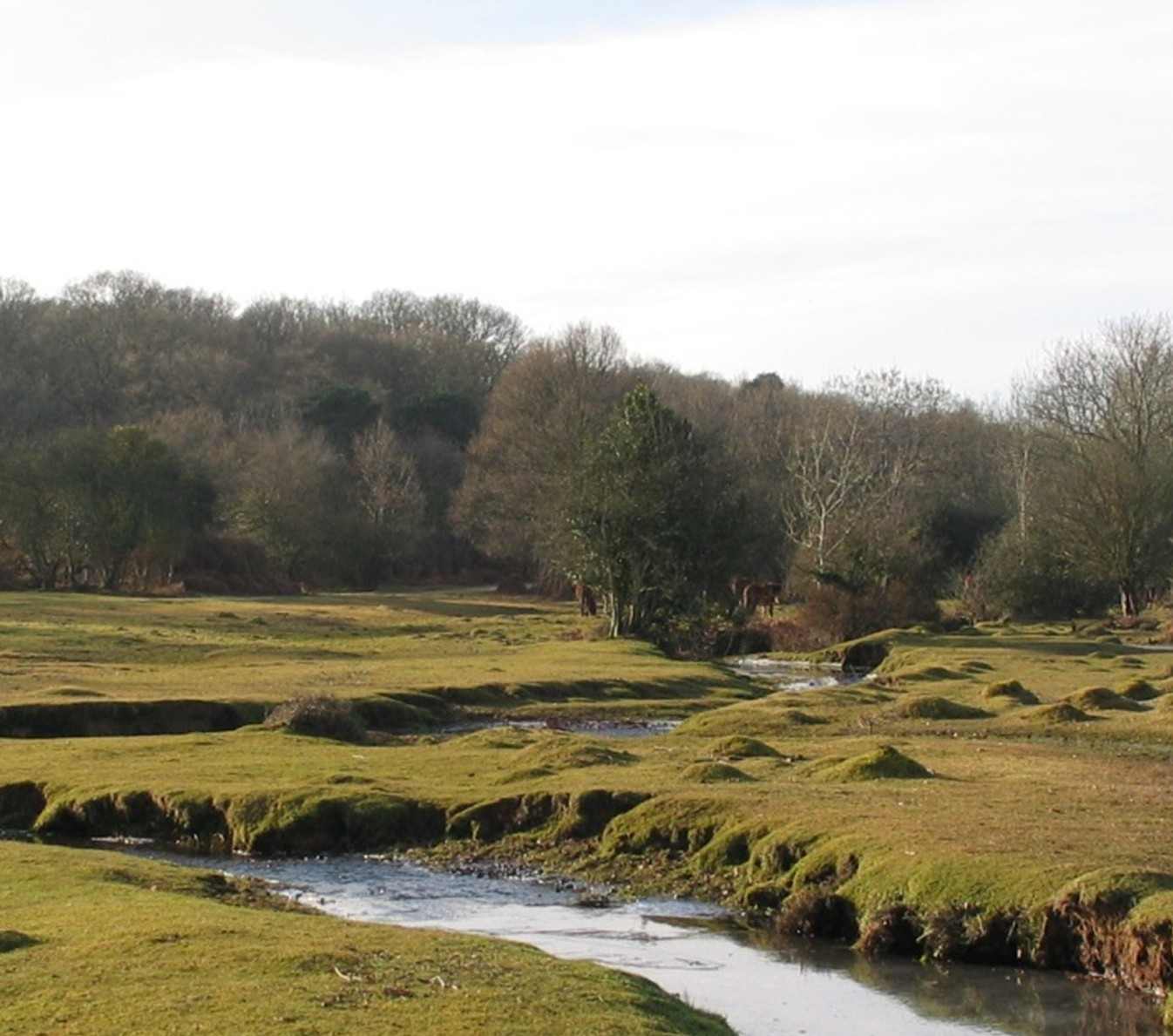
Image Credit: Chris Hill 2018
Project Title: North Devon NIA
Programme: Nature Improvement Area
Project Lead: Devon Wildlife Trust
Partners: North Devon Catchment Partnership (Beaford Arts, Mole Valley Farmers Butterfly Conservation, Natural England, Devon Biodiversity Records Centre, North Devon UNESCO Biosphere, Devon County Council, Plymouth University, Devon Wildlife Trust, Torridge District Council, Environment Agency, University of Exeter, Forestry Commission, Woodland Trust)
Funders: Defra
Nature of funding: Public sector (e.g. Defra)
Habitats: Rivers and streams, Broadleaved, Mixed and Yew Woodland (inc. orchards, wood pasture, lowland and upland woods) , Acid grassland, Improved grassland (e.g. coastal and floodplain grazing marsh), Hedgerows
Dates: 2012 - 2020
Area: 3000
Goals and Objectives: To take an ecosystems-based approach to restore and re-create a wildlife-rich landscape across the internationally important River Torridge catchment, especially within the culm acid wet grasslands and to develop stronger links between environment, economy and local communities. Project is now the Northern Devon Natural Solutions.
Actions: Restoration, creation and connecting key habitats especially clum meadows and semi-natural woodland. Deliver high quality ecosystem services (water quality, flood risk and carbon), enable community understanding, advisory services, economic support through local supply (woodfuel)
Action List: Land / water management, Habitat / natural process restoration, Habitat creation (new features e.g. new woodlands, ponds etc), Incentive programmes / Conservation payments, Advisory Services, Education / Training / Community Awareness
Ecosystem Services: Carbon / Net Zero / GHG, Biodiversity, Flood and Drought, Other
Baseline Monitoring: Yes
Accredited methods: Yes
Who is monitoring: Project team, Volunteers, Consultants, Researchers / Academics
Data available: Yes
High level summary: North Devon Nature Improvement Area restores and reconnects Culm grasslands, woodlands and rivers, enhancing ecosystem services and engaging communities across the Torridge catchment to create a resilient, wildlife-rich landscape.
Outputs: The first three years: 2012 - 15 Progress and learning so far. https://www.devonwildlifetrust.org/sites/default/files/2018-06/NIA_Report_2015.pdf
Project Contact: cth@geodata.soton.ac.uk
Link / URL: https://www.devonwildlifetrust.org/what-we-do/our-projects/northern-devon-nature-improvement-area
Purbeck Heaths National Nature Reserve
Resilient Rivers Monnow
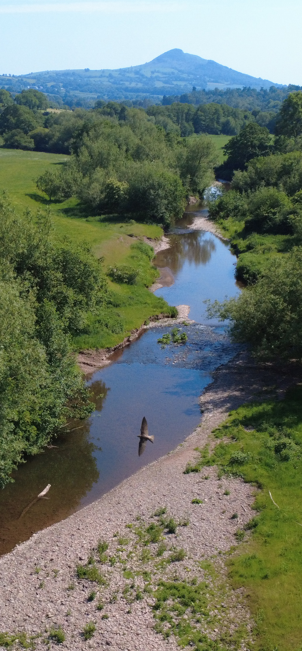
Image Credit: Martin Cray 2026
Project Title: Resilient Rivers Monnow
Programme: Resilient Rivers Monnow
Project Lead: Wye and Usk Foundation
Partners: The project is underpinned by a strong partnership of organisations with complementary responsibilities, expertise and interests in reducing flood risk and improving catchment resilience. Monmouthshire County Council (MCC) is the Lead Local Flood Authority for Monmouthshire and provides an important local perspective on flood risk. MCC has direct knowledge of communities and infrastructure affected by flooding, including the impacts and consequences of major flood events. The Council plays a key role in understanding and managing local sources of flood risk, responding to flooding incidents, supporting affected communities and identifying opportunities to reduce future risk. Its local knowledge and relationships are particularly important in ensuring that project interventions are targeted towards areas where they can provide meaningful benefits. Natural Resources Wales (NRW) provides the strategic and catchment-scale perspective on flood risk management. Its responsibilities include managing flood risk from main rivers, strategic flood risk planning, flood forecasting and warning, flood risk modelling and supporting approaches that reduce flood risk at source. NRW's technical expertise, strategic oversight and understanding of catchment processes are central to developing and evaluating Natural Flood Management approaches as part of a wider flood risk management strategy. Network Rail has part-funded the development of the project and the catchment monitoring and evidence base that underpin it, alongside contributions from other partners. As a major infrastructure asset owner with an interest in reducing flood risk to the rail network, Network Rail brings an important understanding of the potential benefits of upstream interventions in protecting critical infrastructure and improving resilience. Dŵr Cymru Welsh Water (DCWW) has also provided significant support for critical research and development that has helped establish the evidence base for the project. Its interest in catchment resilience, water quality and the interaction between land management and water systems provides an important additional perspective. DCWW is expected to have an ongoing role in the development of the project and future opportunities for investment and delivery. Together, these partners provide a combination of local knowledge, statutory flood risk management responsibilities, strategic and technical expertise, infrastructure interests, research and development capability, and funding. This creates a strong foundation for developing, testing and ultimately scaling practical Natural Flood Management interventions across the catchment.
Funders: Natural Resources Wales Monmouthshire Council Network Rail Dwr Cymru Welsh Water
Nature of funding: Blended funding
Habitats: Rivers and streams, Broadleaved, Mixed and Yew Woodland (inc. orchards, wood pasture, lowland and upland woods), Acid grassland, Calcareous grassland, Neutral grassland, Improved grassland (e.g. coastal and floodplain grazing marsh), Urban (e.g. built and gardens, linear infrastructure), Hedgerows
Dates: 2025 - 2027
Area: 1294 of potential intervention area, 22000 total area
Goals and Objectives: Facilitate the transition into long term, financially viable sustainable farming practices, the local farming community is "farming for water" Demonstrate a transferrable and scalable market approach which can be transferred and upscaled across the UK Reduce the impacts of flooding in the River Monnow catchment, with particular focus on communities in Grosmont, Skenfrtih, Osbaston and Monmouth Increase groundwater storage to improve drought resilience
Actions: Grazing management changes over winter Shelterbelt creation Flow attenuation
Action List: Land / water management, Regenerative practices (Agriculture / soils)*
Ecosystem Services: Flood and Drought
Baseline Monitoring: Yes
Accredited methods: No
Who is monitoring: Project team, Landowner / tenants, Consultants, Researchers / Academics
Data available: No
High level summary: The soils of the River Monnow catchment offer an enormous NFM value as, under the right conditions, they can absorb enormous volumes of water in winter storms, preventing the rain from running across fields and into the watercourse and ultimately reducing flooding downstream. By valuing "water management" as a crop in its own right, we can change the economic framework that land is managed under and so by ensure farmers are paid more and business pays less. The Wye and Usk Foundation is pioneering a groundbreaking approach to deliver this change. We are developing a new market where downstream businesses and users pool their resources to "buy" flood resilience for their infrastructure, funding farmers to "farm for water" as part of their businesses, slowing the flow of water during rainfall before it reaches our towns. This lowers the cost for everyone involved while providing long term funding for farmers, whilst NFM measures also provide additional benefits to farms, such as providing high quality grass for spring lambs, improved soil health and retention.
Outputs: TBC - Planning academic publications co-produced with multiple universities/organisations. Summary report, hydrological modelling report.
Project Contact: james@wyeuskfoundation.org
Link / URL: https://resilientrivers.co.uk/
Ripa Gar-Hutton Glen Lochay Biodiversity Partnership
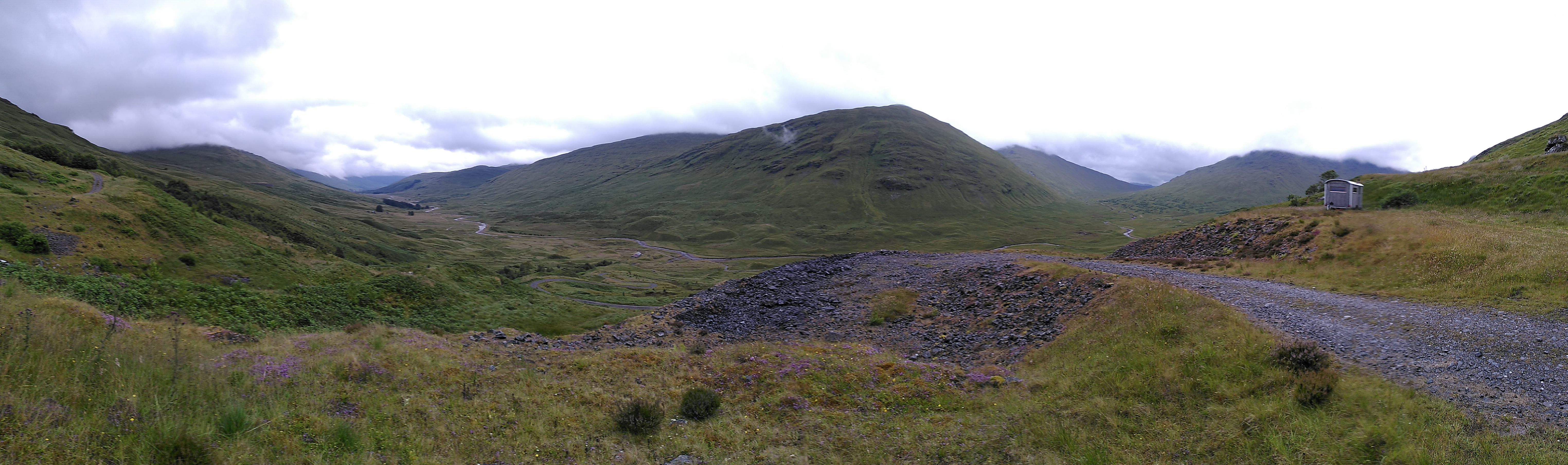
Image Credit: Stuart Smith 2024
Project Title: Ripa Gar-Hutton Glen Lochay Biodiversity Partnership
Programme:
Project Lead: Ripa Gar Foundation
Partners: The James Hutton Institute and Royal Botanic Garden Edinburgh
Funders: Ripa Gar Foundation
Nature of funding: Private sector (individual / estate)
Habitats: Rivers and streams, Standing open water and canals, Broadleaved, Mixed and Yew Woodland (inc. orchards, wood pasture, lowland and upland woods) , Coniferous woodland, Acid grassland, Calcareous grassland, Dwarf shrub heath, Bogs, Montane habitat
Dates: 2019 -
Area: 5666
Goals and Objectives: The primary aim of the Ripa Gar Foundation is to achieve biodiversity, and to so so with as little human intervention as possible. The foundation ensures that this environmental purpose is maintained 'forever', creating an everlasting purpose. The foundation is intended to be a vivid example of alternative perspective that gives nature its own value, regardless of whether or not people perceive it. The aim is to achieve harmony of nature, and a balance created by the self. People are encouraged to find inspiration among the silent uplands of the glen.
Actions: Planting of over 1.5 million native broadleaf and conifer trees to create and open woodland. Creation of tree nursery to support rearing of local genetic tree stock. Planting on montane willow shrubs. Reintroduction of rare plant species including Alpine Blue-sowthistle, Wych Elm and Wild Apple. Fencing to exclude deer and encourage woodland development natural colonisation along with deer culling. Removal of livestock and cattle, apart from summer cattle grazing and soay sheep as food resource for nesting golden eagles and other raptors. Engineering of waterways to create wetland ponds and slow movement of water along the river Lochay.
Action List: Land / water habitat protection (e.g. creating a reserve), Land / water management, Habitat / natural process restoration, Species-specific Management, Habitat restoration and rehabilitation, Natural process mimicry (controls to simulate processes), Habitat creation (new features e.g. new woodlands, ponds etc), Incentive programmes / Conservation payments
Ecosystem Services: Carbon / Net Zero / GHG, Biodiversity, Flood and Drought, Soil Health, Erosion control, Health and Wellbeing, Cultural, Other
Baseline Monitoring: Yes
Accredited methods: Not known
Who is monitoring: Researchers / Academics
Data available: Yes
High level summary: Please see website
Outputs: Please see website
Project Contact: stuart.smith@hutton.ac.uk
Link / URL: https://www.ripagar.com/
Ripa Gar-Hutton Glen Lochay Biodiversity Partnership
Solway Coast and marine Project - Landscape Connections (SCAMP)
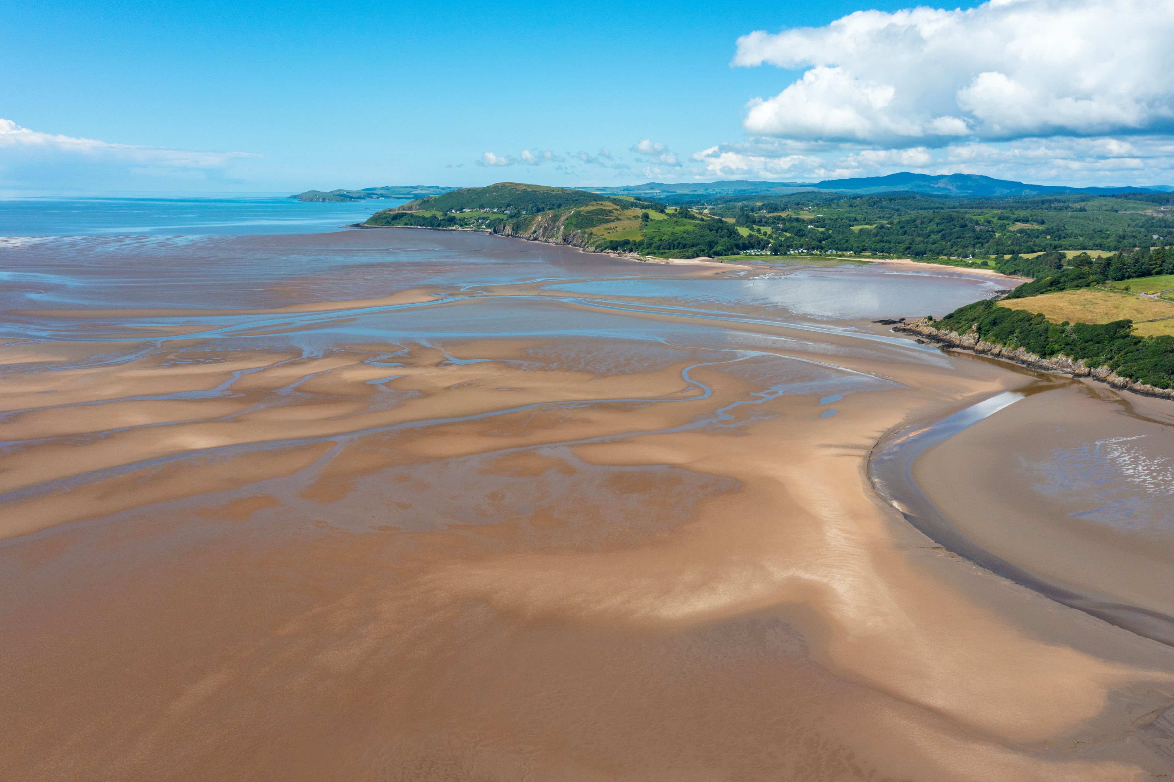
Image Credit: Mike Bowlan
Project Title: Solway Coast and marine Project - Landscape Connections (SCAMP)
Programme: National Lottery Heritage Fund Landscape Connections Programme
Project Lead: Dumfries and Galloway Council
Partners: Galloway and Southern Ayrshire Biosphere, Solway Firth Partnership, Galloway Rivers Trust, Dumfries and Galloway Woodlands, Crichton Carbon Centre, Southern Uplands Partnership, RSPB
Funders: National Lottery Heritage Fund, South of Scotland Enterprise, SEPA, Nature Restoration Fund, SWESTRANS, Holywood Trust, Dumfries and Galloway Council, Borderlands Inclusive Growth Deal
Nature of funding: Public sector (e.g. Defra)
Habitats: Rivers and streams, Broadleaved, Mixed and Yew Woodland (inc. orchards, wood pasture, lowland and upland woods) , Fen, marsh and swamp, Bogs, Sublittoral / marine sediments (e.g. Subtidal Muds, Sands and Gravels - e.g. subtidal seagrass beds)
Dates: 2025 - 2035
Area: 217,000
Goals and Objectives: Solway Coast and Marine Project - Landscape Connections (SCAMP) is an ambitious coastal and marine nature restoration project, seeking to restore the coastal and shallow sea habitats of the Solway, along the entire 210 miles of the Dumfries and Galloway Coastline from Gretna to the Rhins of Galloway. SCAMP plans to explore community-driven initiatives to enhance and restore biodiversity and habitats, both underwater and along the coast. It will support communities to adapt to the effects of climate change, be more resilient to predicted sea level rise, and gain sustainable economic and social benefits.
Actions: We are focusing on the restoration of 6 key habitats, Native oyster reef, seagrass, saltmarsh, sand dunes, coastal woodland and coastal burns as we and access to the coast for local people and visitors through the improvement of coastal infrastructure, education and training and economic development for costal communities, utilising the arts and culture to engage local communities
Action List: Land / water habitat protection (e.g. creating a reserve), Land / water management, Habitat / natural process restoration, Invasive/problematic species control (e.g. Rhododendron control), Habitat restoration and rehabilitation, Habitat creation (new features e.g. new woodlands, ponds etc), Habitat linking (joining isolated habitats), Education / Training / Community Awareness
Ecosystem Services: Carbon / Net Zero / GHG, Biodiversity, Water Quality, Improved farm economics, Health and Wellbeing, Cultural, Recreation and tourism
Baseline Monitoring: Yes
Accredited methods: Yes
Who is monitoring: Project team, Volunteers, Consultants, Researchers / Academics
Data available: No
High level summary: The Solway Firth is one of the largest and least industrialised estuaries in Europe, with a diverse marine ecosystem. Solway Coast and Marine Project - Landscape Connections (SCAMP) is an ambitious coastal and marine nature restoration project, seeking to restore the coastal and shallow sea habitats of the Solway, along the entire 210 miles of the Dumfries and Galloway Coastline from Gretna to the Rhins of Galloway. SCAMP plans to explore community-driven initiatives to enhance and restore biodiversity and habitats, both underwater and along the coast. It will support communities to adapt to the effects of climate change, be more resilient to predicted sea level rise, and gain sustainable economic and social benefits.
Outputs: Currently in development
Project Contact: karen.morley@dumgal.gov.uk
Link / URL: https://www.solwaycoastmarine.co.uk/
Solway Coast and marine Project - Landscape Connections (SCAMP)
Teifi Fyw - Pobl a Natur gyda'i gilydd / Living Teifi - People and Nature Together
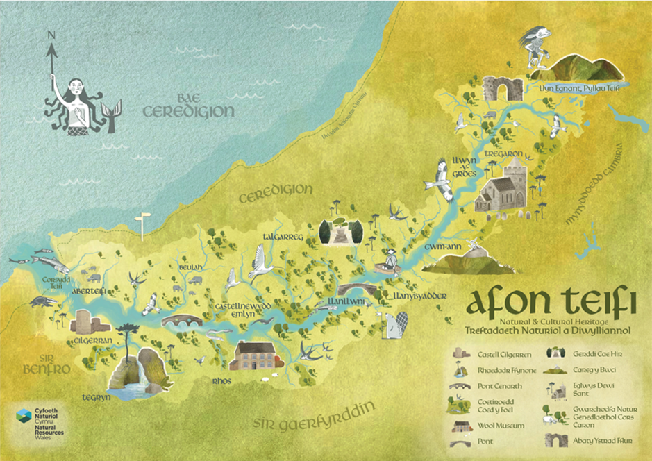
Image Credit: Natural Resources Wales
Project Title: Teifi Fyw - Pobl a Natur gyda'i gilydd / Living Teifi - People and Nature Together
Programme: Teifi Demonstrator Project
Project Lead: Cyfoeth Naturiol Cymru / Natural Resources Wales
Partners: Natural Resources Wales, Mentera, West Wales River Trust, IBERS - Aberystwyth University, Strata Florida Trust, UNESCO Bridges - University of Wales Trinity Saint David's, Wildlife Trust South West Wales, Ceredigion County Council, Mining Remediation Authority
Funders: National Lottery Heritage Fund, Natural Resources Wales, Welsh Government, Welsh Water
Nature of funding: Public sector (e.g. Defra)
Habitats: Rivers and streams, Broadleaved, Mixed and Yew Woodland (inc. orchards, wood pasture, lowland and upland woods), Coniferous woodland, Neutral grassland, Improved grassland (e.g. coastal and floodplain grazing marsh), Cropland (arable and horticulture / orchards), Urban (e.g. built and gardens, linear infrastructure), Hedgerows, Bogs
Dates: 2026 - 2033
Area: 100800
Goals and Objectives: Teifi Fyw aims to create a shared vision and practical roadmap for the future of the River Teifi catchment by bringing together communities, partner organisations and stakeholders to identify and develop solutions that enhance environmental resilience, support sustainable land management, celebrate cultural heritage and strengthen local wellbeing. By aligning local priorities with national policy objectives for nature recovery, climate resilience, sustainable resource management and community-led decision-making, the project will establish the governance, evidence base and investment framework needed to deliver long-term, catchment-scale change and secure a sustainable future for the Teifi and the communities that depend upon it.
Actions: Partners will work collaboratively with communities, farmers, landowners, river users, businesses and stakeholders across the Teifi catchment to collect, share and interpret scientific data, local knowledge, oral histories and lived experience through the Voices of the Teifi approach. Activities include undertaking community engagement and storytelling, training and supporting Cultural Connectors, carrying out ecological surveys and baseline monitoring, developing whole-farm plans, exploring regenerative land management practices, assessing opportunities for river restoration and habitat connectivity, investigating nature-based solutions, capturing and celebrating cultural heritage and Welsh language traditions, delivering workshops, river festivals and community learning events, facilitating stakeholder dialogue through the Teifi Fyw Forum, and developing governance arrangements, investment models and funding mechanisms that support long-term catchment stewardship. Together, these activities enable communities and partners to identify priorities, shape future interventions and develop an integrated programme of action that reflects both the needs of people and the resilience of the Teifi catchment.
Action List: Land / water habitat protection (e.g. creating a reserve), Land / water management, Habitat / natural process restoration, Species-specific Management, Invasive/problematic species control (e.g. Rhododendron control), Habitat restoration and rehabilitation, Habitat buffering (buffer zones from external threats), Advisory Services, Education / Training / Community Awareness, Regenerative practices (Agriculture / soils)*
Ecosystem Services: Biodiversity, Water Quality, Soil Health, Erosion control, Health and Wellbeing, Cultural, Recreation and tourism
Baseline Monitoring: Yes
Accredited methods: No
Who is monitoring: Project team, Landowner / tenants, Volunteers, Consultants, Researchers / Academics
Data available: Not known
High level summary: Teifi Fyw (Living Teifi) is a pioneering catchment-scale development programme led by Natural Resources Wales and a partnership of 9 organisations, working across the entire River Teifi catchment to create a long-term, community-led vision for the river and its surrounding landscapes. Rather than focusing solely on environmental restoration, the project combines nature recovery, regenerative farming, cultural heritage, Welsh language and identity, community participation, and sustainable investment into a single framework. During its current Development Phase, Teifi Fyw is gathering and integrating scientific evidence with local knowledge, oral histories, lived experience and community aspirations through its unique Voices of the Teifi approach, with the aim of producing an Area Action Plan, establishing a Teifi Fyw Forum for shared decision-making, and developing a strong National Lottery Heritage Fund Delivery Phase application capable of delivering lasting environmental, social, cultural and economic benefits across the Teifi catchment.
Outputs: Outputs & data will be published via NRW channels upon completion of the Development Phase (2026-28)
Project Contact: jon.parker@cyfoethnaturiolcymru.gov.uk
Teifi Fyw - Pobl a Natur gyda'i gilydd / Living Teifi - People and Nature Together
